Guestblog from The Husband:
It's fall and that means the aspen groves up and down the east side of the Sierra Nevada are in color. I drove up from the Bay Area and over the mountains at Lake Tahoe. US 395 runs from the Canadian border to San Diego, and I drove south on it as far as Bishop.
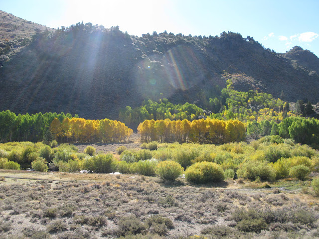
This is a large grove just before Conway Summit, a little north of Mono Lake. There's a matching grove just south of the summit, but it was in shadow.
I drove past Lee Vining to go through the June Lake Loop a little before sunset. This is probably June Mountain. Not much farther is the village of June Lake, and the Tiger Bar, est'd 1936. That night I stayed at Lee Vining.
And here's the same picture the next morning.
Aspens above the lakes in the June Lake Loop.
Trees in the canyon between Grant Lake and Silver Lake.
Next to Silver Lake.
Moving on down the road, a prominent mountain looms in the distance. How to get to it? It turns out, it's on the far side of Convict Lake, two miles up a road from the highway. The best color is at the far end.
And the prominent mountain? Mt. Morrison, here in the distance. 12,241 feet tall with an imposing east face, Wikipedia says its nickname is Eiger of the Sierra. It also says the east face is loose and dangerous.
Here we are entering McGee Canyon, just west of Crowley Lake. This is the pack station that serves McGee Creek Pass, Red and White Mountain, Red Slate Mountain, and dozens of lovely high Sierra lakes.
The grove just past the pack station.
Farther and
farther up the canyon.
Down the road a piece to Rock Creek Canyon. You enter it by stopping for lunch at Tom's Place, a Sierra fishing and hiking resort that's been there since 1917. The people are friendly and the food won't kill you.
 |

The road head at Rock Creek Canyon is at about 10,200 feet, high enough that you run out of aspens.
At the head of the canyon is Bear Creek Spire, 13,713 feet high.
Rock Creek.
And back down into the desert. Coming down the road to Bishop. The big mountain on the right is probably Mt. Tom. The one to the left with the hatchet-shaped crest is Mt. Humphreys.
This is in Bishop Canyon just past Aspendell. Lamarck Col is up there on the left somewhere, not far from Paiute Pass to the right.
Just at the outfall at Lake Sabrina, the highest of the power plants in the canyon. Notice the electric wires coming through the trees.
The next day, my third and last, I woke up in Bishop to heavy rain. I left to come home, and drove through off-and-on rain to Lee Vining and then Tioga Pass, the east entrance to Yosemite National Park. It was rain to 8,000', where it turned to snow. At 9,000', the snow was sticking to the ground. At 10,000, at the pass, it was snowing hard and starting to pile up. I began to worry that the road would fill in before I got across it. But below 9,000' at Tuolumne Meadows, all was well. Home by 3:00 PM.


1 comment:
Tom, vous avez eu la chance. La neige est dificile pour conduire la voiture! Barbara
Post a Comment